The University of Exeter team has decoded a late 18th/early 19th-century Kachchhi/Gujarati navigational scroll from the Royal Geographical Society, identifying all 66 Devanagari place names and mapping over 180 islands. The researchers decoded astronomical notations, established latitude readings and produced a spatial projection that aligns the scroll with modern coordinates. The 25 cm-wide scroll uses 29 rhumb lines for coastline trends, open-water bearings and safe port passages and functioned as a mnemonic guide for experienced local seafarers.
Two-Century-Old Red Sea Navigational Scroll Decoded — Lost Seafaring Knowledge Revealed
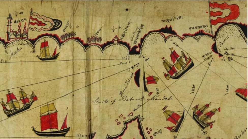
The Indian, Kachchhi/Gujarati, document. (photo credit: University of Exeter)
Researchers have decoded a late 18th/early 19th-century Kachchhi/Gujarati navigational scroll from the Royal Geographical Society collection, revealing an indigenous system of navigation used in the Red Sea and Gulf of Aden long before widespread instrument-based charts.
The hand-drawn chart, acquired by Alexander Burnes in 1835 and held by the Society for 189 years, records more than 180 islands, numerous reefs and coastal landmarks, illustrations of ships and religious buildings, and a series of flags. Sixty-six place names are written in Devanagari script; until now these names had not been systematically identified or placed on modern maps.
What the Researchers Found
A University of Exeter research team produced improved transcriptions of the Devanagari labels and matched all 66 previously unidentified names to real-world locations. They also decoded astronomical notations on the scroll, establishing latitude readings and sailing directions. Using that data, the team produced a spatial projection of the scroll that corresponds with modern geographic coordinates.
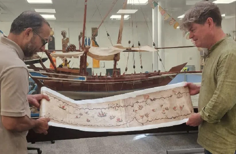
Researchers at University of Exeter with the Indian, Kachchhi/Gujarati, document, July 24, 2026. (credit: University of Exeter)
Rhumb Lines and Practical Use: The chart contains 29 rhumb lines that the researchers say served three distinct functions: marking the principal trend of coastlines, indicating bearings for open-water crossings, and — in at least two cases — showing safe approaches into and exits from ports. Combined with stellar information for latitude, place names and topographical cues, the scroll functioned as a compact, practical navigational reference for experienced seafarers.
“Although this chart does not look accurate to us in a modern sense, it enabled experienced seafarers, using stellar navigation, to negotiate some of the most dangerous waters in the world,” said Professor John Cooper of the University of Exeter's Institute of Arab and Islamic Studies.
Cooper emphasized that the 25 centimetre–wide scroll was tailored for users with local maritime experience. Its inscriptions served as mnemonic prompts: enough information for those initiated into regional seafaring traditions, but not a standalone manual for novices. The scroll format allowed sailors to display only the relevant portion while keeping the rest rolled up — practical for use aboard small ships.
Dr Katherine Parker, Cartographic Collections Manager at the Royal Geographical Society, said the study demonstrates the value of re-examining historical collections with modern methods. "Revisiting archives with new tools can reveal the practical meaning and cultural importance of artefacts that were previously misunderstood or underappreciated," she said.
Significance
The project highlights a sophisticated indigenous navigation tradition in the Indian Ocean region that complements — and in some cases predates — Western instrument-based charting. By producing accurate transcriptions, coordinates and a spatial projection, the researchers have made a once-obscure maritime resource legible to contemporary historians, mariners and the public.
Help us improve.