European Space Agency's Mars Express captured November 2024 HRSC images of Utopia Planitia showing ancient volcanic ash spreading across the plain and evidence of buried ice. China's 2021 Zhurong rover found coastal sediments that support the idea Utopia once hosted a vast sea. Features such as scalloped depressions and extensive grabens point to active surface change driven by ice sublimation, wind transport, and tectonic extension.
Mars Express Images Reveal Ancient Volcanic Ash Sweeping Utopia Planitia — Hidden Ice and Active Surface Change
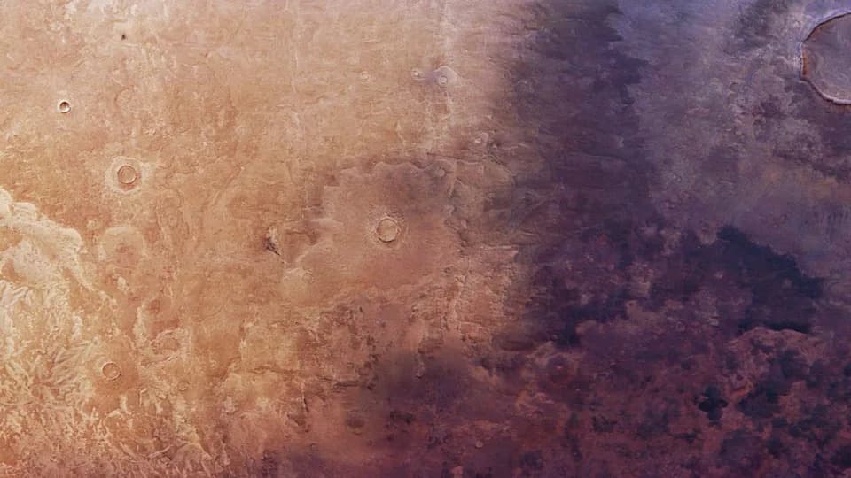
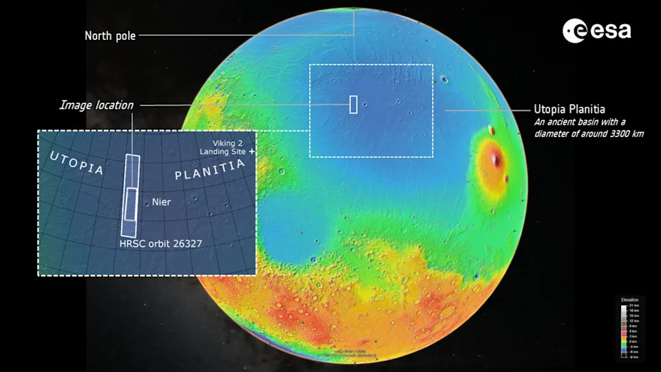
The wide strip of land in Utopia Planitia imaged by Mars Express. The dark volcanic material is on the right, while grabens can be seen on the left. . | Credit: ESA/DLR/FU Berlin
Europe's Mars Express orbiter has captured high-resolution images of Utopia Planitia that reveal ancient volcanic ash spreading across the plain and clear signs of buried ice reshaping the surface. The new frames, taken by the High Resolution Stereo Camera (HRSC) in November 2024, show how Martian landscapes can change noticeably over decades.
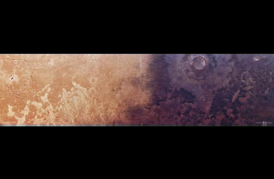
The wide strip of land in Utopia Planitia imaged by Mars Express. The dark volcanic material is on the right, while grabens can be seen on the left. | Credit: ESA/DLR/FU Berlin
Utopia Planitia and Its Watery Past
Utopia Planitia is a vast northern lowland about 2,100 miles (3,300 kilometers) across. Scientists interpret it as the scar left by an impact from a small dwarf-planet body roughly 4.1–4.3 billion years ago. Data from China's Zhurong rover in 2021 found coastal sediments consistent with an ancient shoreline, supporting the idea that Utopia once held a large sea that connected into the neighboring Vastitas Borealis basin.
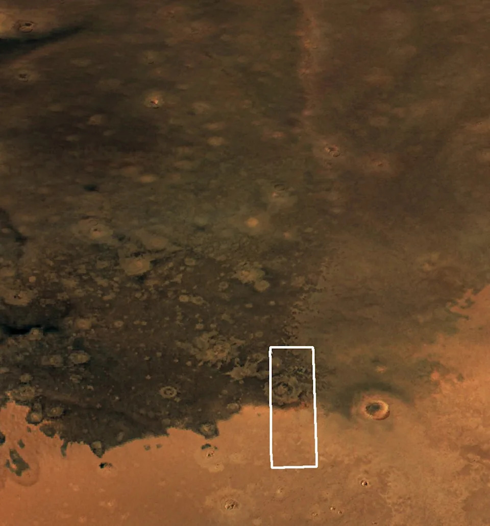
A comparison of the dark ash coverage in Utopia Planitia between Viking in 1976 and Mars Express in 2024. | Credit: NASA/ESA
Volcanic Ash Moving Across the Plain
When the Viking orbiters imaged Utopia in the late 1970s they recorded reddish-caramel tones alongside darker patches. Those darker areas are now identified as ancient volcanic ash rich in minerals such as olivine and pyroxene. Mars Express' 2024 images show this dark layer covering larger swathes of the plain than in Viking-era photos. Researchers propose two main explanations: either wind is transporting the ash across the surface, or lighter, dustier surface deposits are being eroded away, exposing the darker substrate beneath.
Credit: NASA/USGS; ESA/DLR/FU Berlin
Buried Ice, Scalloped Depressions and Polygonal Floors
Radar data from NASA's Mars Reconnaissance Orbiter (SHARAD) first detected significant subsurface ice in this region in 2016. As that ice slowly sublimates, the overlying ground can collapse and form scalloped depressions—pits with undulating, ribbed margins. These depressions may merge into larger hollows whose floors often display polygonal patterns formed by stresses from repeated freeze–sublimation cycles as Mars' climate shifts over long timescales, influenced in part by changes in the planet's axial tilt.
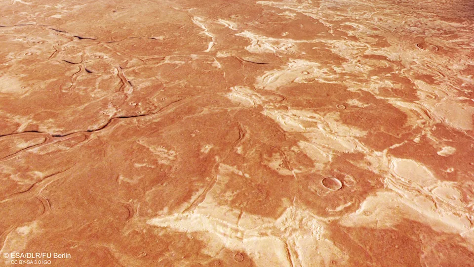
Credit: ESA/DLR/FU Berlin
Grabens and Tectonic Extension
The Mars Express images also capture dark, linear crevasses—grabens—up to about 12.4 miles (20 kilometers) long and roughly 1.2 miles (2 kilometers) wide. Grabens form when blocks of crust drop down between faults, typically where tectonic stresses pull the crust apart. On Mars, these structures can weave into complex networks and intersect to produce larger polygonal patterns similar to those seen in scalloped depressions. These particular grabens may be much older than the scalloped features and could date back to the era when the sea that once filled Utopia Planitia disappeared more than four billion years ago.
Why This Matters
Combined, these observations show that Mars remains geologically active on regional scales: wind, ice sublimation, and tectonic processes all continue to reshape its surface. The images not only refine our understanding of Utopia Planitia's watery past but also highlight modern processes that alter planetary landscapes on human-observable timescales.
Image Credit: ESA / DLR / FU Berlin (G. Neukum)
Help us improve.