Jamming and spoofing since recent US‑Israeli strikes have left about 1,000 ships in the Gulf and Gulf of Oman unable to fix their positions. Many commercial vessels rely solely on the decades‑old civilian L1 C/A GPS signal and cannot switch to Galileo or BeiDou when that signal is lost. Spoofing can also corrupt AIS and report false positions, while GPS outages disrupt onboard clocks, radar timing and speed logs. Although alternative navigation technologies are in development, practical replacements for large‑ship navigation are not yet widely available.
Why About 1,000 Ships in the Middle East Lost GPS — How Jamming and Spoofing Are Disrupting Navigation
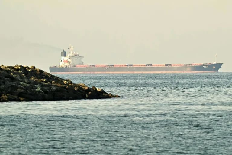
Vessels in the Middle East -- here, a cargo ship in the Strait of Hormuz -- are battling difficulties with their outdated GPS capabilities (Giuseppe CACACE)(Giuseppe CACACE/AFP/AFP)
Since recent US‑Israeli strikes, jamming and spoofing of satellite navigation signals have left roughly 1,000 ships in the Gulf and the Gulf of Oman unable to determine their positions either intermittently or continuously. The disruption highlights how commercial vessels often rely on much older GPS hardware than modern smartphones, leaving them exposed when signals are contested.
How Satellite Navigation Works
Global navigation satellite systems (GNSS) use constellations of satellites that broadcast extremely precise time signals. Receivers on the ground use the timing of those signals to calculate location. Modern smartphones typically combine signals from four GNSS constellations — the U.S. GPS, Europe’s Galileo, Russia’s GLONASS and China’s BeiDou — and listen on multiple frequency bands for greater resilience.
Why Many Ships Are Vulnerable
By contrast, most commercial ships are equipped only to receive the original civilian GPS signal, known as the L1 C/A signal, a standard released for civilian use in the early 1990s. “Many ships only listen to the original civilian GPS signal,” said Todd Humphreys, an engineering professor at the University of Texas at Austin. That limited capability prevents many vessels from switching to Galileo or BeiDou when the L1 signal is jammed.
Traffic analyst Dimitris Ampatzidis of Kpler told AFP that the roughly 1,000 affected vessels represent about half of ships in the area, with the majority off the coasts of the United Arab Emirates and Oman.
Jamming vs. Spoofing
GPS jamming is relatively simple: a stronger transmitter broadcasting on the same frequency can overwhelm the genuine satellite signals and create what one historian calls a “wall of mush.” Katherine Dunn, author of Little Blue Dot, explains that jamming is usually a brute‑force interference.
Spoofing is more sophisticated and can be far more disruptive. It can target a ship’s Automatic Identification System (AIS), the radio system that transmits identity, destination and position about once per second. A successful spoof can make a vessel report false locations — even placing it on land — which can sow confusion, create collision risks, and complicate search and rescue.
Operational Consequences Onboard
GPS data do more than provide position. They feed onboard clocks, radar synchronisation and speed logs. Loss or corruption of those signals can impair navigation, timing, and coordination. A merchant marine captain told AFP that the electronic aids required to steer very large modern vessels mean crews must often revert to 20th‑century techniques — radar fixes, visual landmarks, and manual plotting — when satellite signals fail.
Why States Use Jamming
Signal jamming is being used both defensively and offensively. Some Gulf states point jamming systems toward their own waters to blunt Iran’s satellite‑guided Shahed drones, accepting domestic disruption as an acceptable trade‑off. Israel employed similar measures in 2024, and Iran also used jamming during its 12‑day conflict with Israel last year. As Humphreys put it, governments will tolerate local disruption if they believe it improves security.
Responses And Future Alternatives
Short‑term responses include greater awareness, manual navigation practices, and operational restrictions in contested waters. In the longer term, start‑ups and research teams are developing alternatives — such as navigation based on Earth’s magnetic field, improved inertial navigation systems, and multi‑GNSS receivers — to increase resilience. However, practical, widely deployed replacements for GPS on large ships remain some way off.
Bottom line: The incident underscores a systemic vulnerability in maritime navigation: many commercial vessels depend on decades‑old GPS hardware and are highly exposed when satellite signals are intentionally disrupted.
Help us improve.