Pyrocumulonimbus are thunderstorm clouds generated by the extreme heat of wildfires that lift smoke, ash and vapour into unstable air. These fire-driven storms create erratic winds and lightning that can fling embers miles ahead and ignite new blazes, making fires far harder to control. Authorities link a pyrocumulonimbus to the large Gironde fires near Bordeaux, where evacuations continue and a heatwave up to 40°C may prolong the blazes. Past events in Australia and the US show how such clouds turn wildfires into unpredictable, self-amplifying disasters.
When Fires Make Their Own Storms: How Pyrocumulonimbus Turn Wildfires Deadly
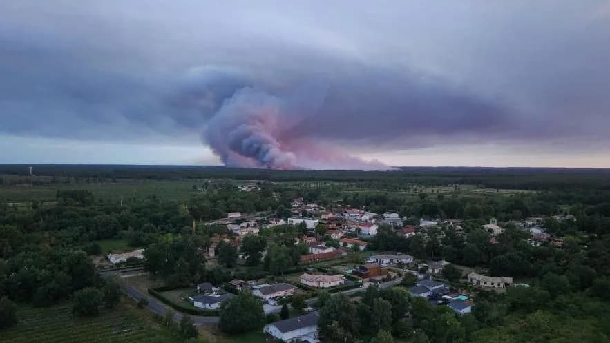
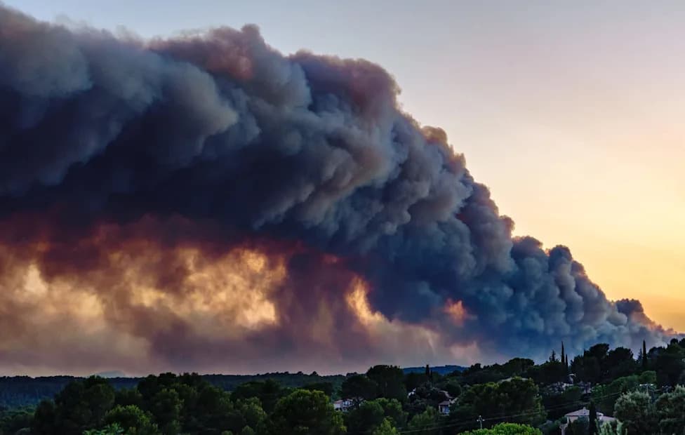
Described by scientists as a "fire-generated thunderstorm", pyrocumulonimbus clouds are created in the skies of France [Reuters]
Tens of thousands of residents have been evacuated from the Gironde region around Bordeaux as French authorities battle wildfires that generated an unprecedented pyrocumulonimbus — a thunderstorm driven by the fire itself.
What Is a Pyrocumulonimbus? Scientists often call these formations fire-generated thunderstorms because the blaze supplies the energy that builds the cloud. Intense heat from flames forces the air above a fire to rise rapidly, carrying smoke, ash and water vapour high into the atmosphere. As that air cools, the water vapour condenses into cloud. If the blaze is powerful enough and the surrounding atmosphere is unstable, that cloud can grow into a towering cumulonimbus — the same type of cloud associated with conventional thunderstorms.
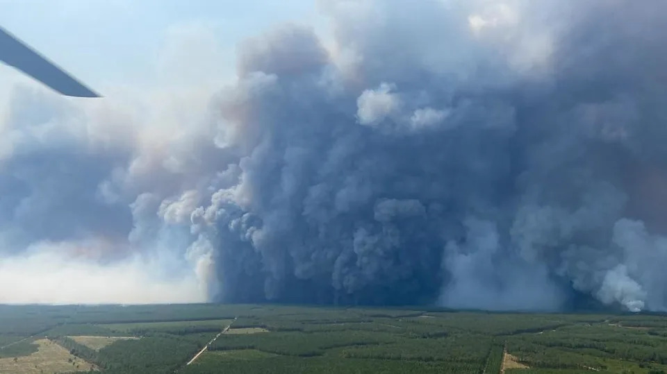
French firefighters that blazes may have caused an unprecedented pyrocumulonimbus cloud [EPA/Shutterstock]
Why They Make Fires More Dangerous
Pyrocumulonimbus clouds can dramatically change fire behaviour. They generate turbulent, erratic winds that hurl embers far ahead of the main front, sometimes tens of kilometres, sparking spot fires and making containment unpredictable. The clouds also produce lightning that can ignite new blazes miles away. Together, these effects can turn a single wildfire into a multi-front, fast-moving event that resists standard suppression tactics.
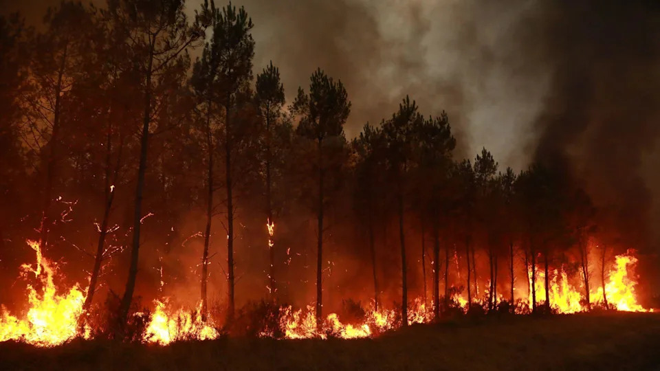
Smoke billows into the sky from wildfires in Saint-Jean-d'Illac, France [Getty Images]
"The fire‑breathing dragon of clouds" — the phrase NASA used to describe pyrocumulonimbus when they channelled massive smoke plumes into the upper atmosphere while producing lightning, fierce winds and localized rain.
Climate And Weather Context
Across Europe this summer, record heatwaves and sparse rainfall have left vegetation and soils unusually dry and flammable. French authorities warned the Gironde wildfire may burn for many weeks and could take months to be fully extinguished, with forecasts of another heatwave pushing temperatures up to 40°C (104°F) in parts of the country — conditions that favour further pyrocumulonimbus development.
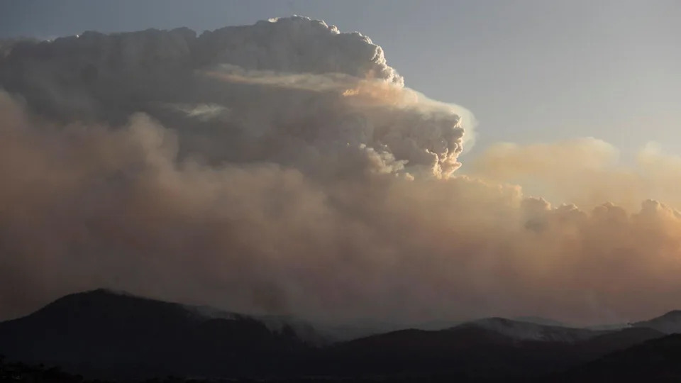
A pyrocumulonimbus cloud generated by the Orroral Valley bushfire to the south of the Australian capital Canberra in January 2020 [Getty Images]
Historic Examples
Powerful pyrocumulonimbus events have been documented in recent catastrophic fire seasons. During Australia’s 2019–2020 Black Summer, extreme firestorms produced their own severe weather, contributing to one of the nation’s most destructive seasons: at least 33 people died (including four firefighters) and more than 11 million hectares (110,000 sq km) burned. New South Wales fire officials reported embers landing as far as 18 miles (30 km) ahead of the fire front.
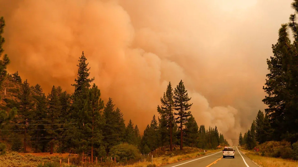
Smoke rising in Markleeville, California during the July wildfires in 2021 [Getty Images]
Similarly, in the summer of 2021, intense fires across the western United States generated pyrocumulonimbus that towered roughly a mile (1.6 km) above the blazes. Officials reported more than 7,300 wildfires that season across about 1 million hectares (2.5 million acres), with multiple firefighter fatalities.
Implications
Events in Gironde, Australia and the western US show how pyrocumulonimbus can transform wildfires into self-sustaining atmospheric disturbances that complicate suppression, endanger communities and amplify environmental damage. Emergency services face a rapidly changing threat environment: evacuation planning, early detection, wide perimeter control and regional coordination become even more critical when fires can create their own storm systems.
What To Watch For — Rapidly shifting winds, increased spot fires far ahead of a main front, visible towering smoke columns and localized lightning are signs that a fire may be producing pyrocumulonimbus activity. When authorities issue evacuation orders, follow them promptly; such clouds can make conditions dangerous in unexpected places.
Help us improve.