The DESI Legacy Imaging Survey has published the largest 2D color map of the sky: 5.6 trillion pixels and nearly 4 billion catalogued objects covering about 75% of the sky. Built from 263,407 exposures collected over 13 years (DECaLS, MzLS, BASS) and augmented with NASA WISE data, the map is publicly accessible via the Legacy Survey Sky Viewer. It underpins DESI's spectroscopic target selection, supports studies of lenses, supernovae, and galaxy evolution, and will help train AI tools for Rubin and Roman observatories.
Explore 5.6 Trillion Pixels: The Largest 2D Map of the Sky — Public and Scrollable
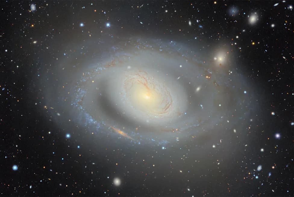
Image: Newscenter
Five-point-six trillion pixels. Nearly four billion catalogued celestial objects. Roughly three-quarters of the sky combined into a single, publicly accessible color image. The DESI Legacy Imaging Survey team has released the largest two-dimensional color map of the universe ever assembled — and the most striking detail may be that you can open it in a browser and begin scrolling through the cosmos right now.
This effort represents more than a decade of observing and data processing. Three ground-based programs supplied the optical imaging that forms the map's backbone: the Dark Energy Camera Legacy Survey (DECaLS), the Mayall z-band Legacy Survey (MzLS), and the Beijing–Arizona Sky Survey (BASS). Together they contributed 263,407 telescope exposures collected over 13 years, augmented with infrared measurements from NASA's WISE satellite and processed at the National Energy Research Scientific Computing Center (NERSC).
What the release contains
- 5.6 trillion image pixels and nearly 4 billion catalogued celestial objects.
- Coverage of about 75% of the sky in visible and near-infrared wavelengths, focused on regions with minimal Milky Way dust obscuration.
- Data assembled into a single, zoomable color image available via the Legacy Survey Sky Viewer.
Why this matters
Think of this 2D map as a satellite-style base layer for astronomy — like a Google Maps for the night sky. It tells researchers where sources are and how bright they appear, which is essential input for next-step observations. DESI (the Dark Energy Spectroscopic Instrument) uses the imaging catalog to select targets for its spectrograph, which measures redshifts and builds the three-dimensional picture of the universe's large-scale structure.
The Legacy Survey maps are already scientifically productive: earlier portions of the dataset have been cited in more than 1,800 scientific papers. The new, unified release will expand those uses and accelerate follow-up science.
Future uses and downstream impact
Beyond DESI target selection, astronomers plan to mine the dataset for rare gravitational lenses and transient events like supernovae, study galaxy evolution across cosmic time, and train machine-learning tools for upcoming facilities such as the Vera C. Rubin Observatory and the Nancy Grace Roman Space Telescope. A baseline this deep and wide will serve as reference infrastructure for the next decade of observational astronomy.
“The skies belong to everyone,” said Arjun Dey of NOIRLab, and David Schlegel described the Sky Viewer as part of “the fabric of astronomy research.”
How to access it
The full map is publicly viewable now through the Legacy Survey Sky Viewer. No credentials are required — anyone can pan and zoom through nearly four billion catalogued objects. For professional astronomers, survey teams, and citizen scientists alike, the release offers both immediate discovery opportunities and a durable reference layer for future missions.
For more technical details and download options, visit the DESI Legacy Imaging Survey and the Legacy Survey Sky Viewer resources published by the survey team and NOIRLab.
Help us improve.