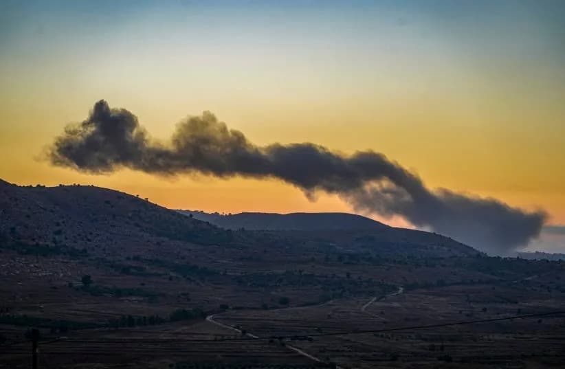
Al Jazeera’s open‑source probe finds Israeli forces control an estimated 1,000 sq km (386 sq miles) across Gaza, southern Lebanon and southern Syria — a footprint larger than New York City and about 5% of Israel’s pre‑October 2023 territory. Official ceasefire maps repeatedly understate where forces actually operate: Gaza’s post‑ceasefire "Yellow Line" was breached, Lebanon saw demolitions beyond declared buffers, and Syria hosts a quiet network of outposts plus 800+ incursions. Analysts call the pattern "strategic deception," warn it substitutes for military success, strains logistics and persists amid limited international pushback.
Al Jazeera Probe: Israeli Forces Extend De Facto Control By ~1,000 sq km Beyond Official Ceasefire Lines
(Al Jazeera)
An Al Jazeera open‑source investigation finds that Israeli forces have established a de facto military footprint of roughly 1,000 sq km (386 sq miles) across the Gaza Strip, southern Lebanon and southern Syria since the war began on October 7, 2023. That area — larger than New York City — amounts to about 5% of Israel’s pre‑October 2023 land area when the occupied Palestinian territories and the occupied Golan Heights are included in the calculation.
Methods and Key Findings
The probe compared official Israeli maps published after various ceasefire deals with satellite imagery, geographic information system (GIS) analysis and data from the Armed Conflict Location and Event Data Project (ACLED). Investigators found a persistent gap between the boundaries Israel publicly declared and where its forces actually operate on the ground in Gaza and southern Lebanon, as well as an unreported but entrenched presence in southern Syria.
(Al Jazeera)
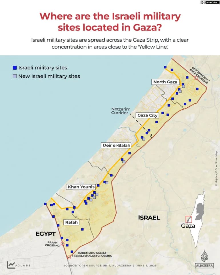
Gaza: The "Yellow Line" And Repeated Advances
Following an October 2025 ceasefire, Israeli authorities introduced a so‑called "Yellow Line" intended to mark control of roughly 200 sq km (77 sq miles) in Gaza. Satellite and ground analysis showed forces repeatedly pushed beyond those limits. In northern Gaza, documented operational control expanded from 67.3 sq km (26 sq miles) to 73.9 sq km (28.5 sq miles), representing 54.7% of the north. Imagery also confirmed widespread demolitions outside declared zones, including in Shujayea.
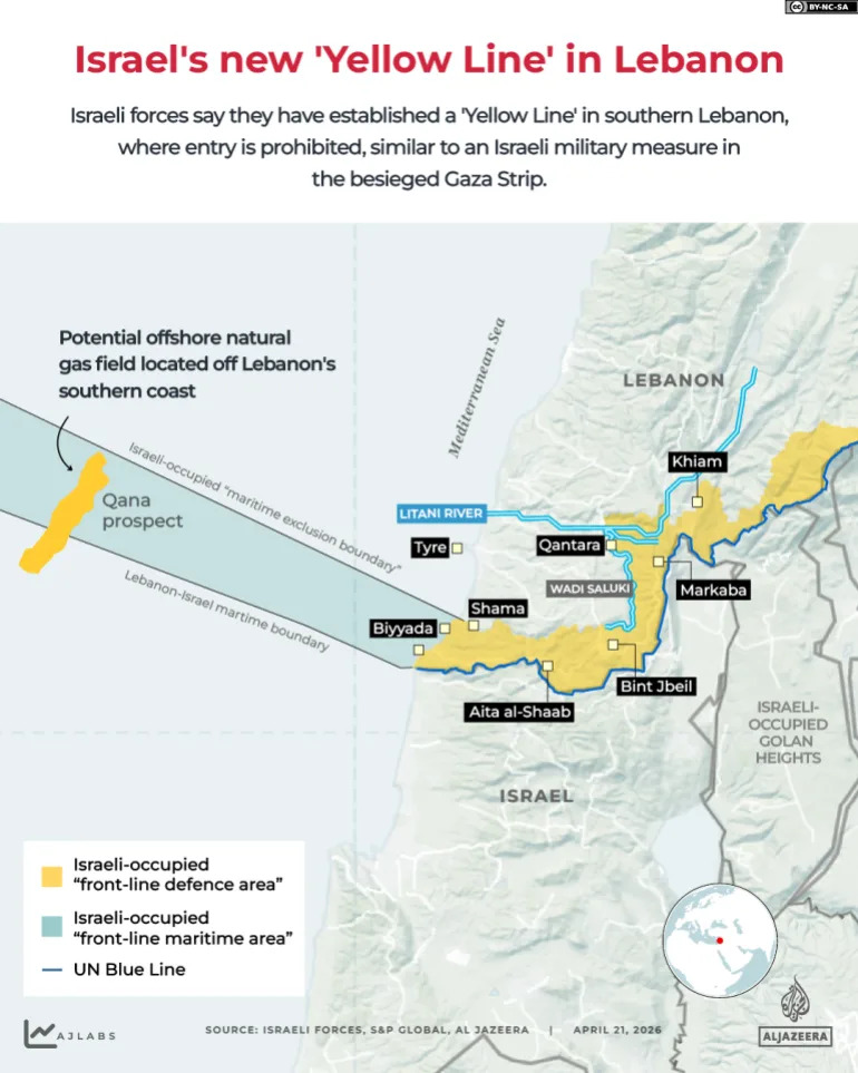
Southern Lebanon: Buffer Zones Versus Reality
After the April 2026 ceasefire, Israeli maps described a buffer zone of about 570 sq km (220 sq miles) in southern Lebanon. Subsequent satellite imagery, however, recorded demolitions and military activity in towns explicitly outside the published lines, notably Zawtar al‑Sharqiya.
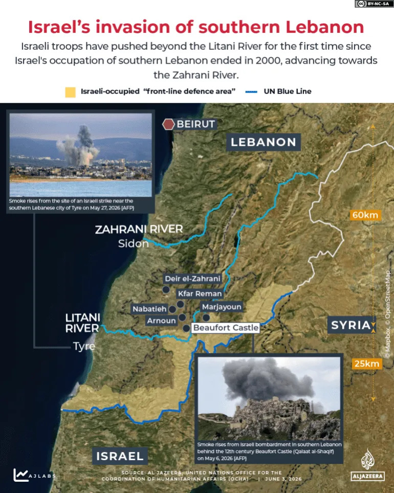
INTERACTIVE - LEBANON YELLOW LINE_MAY31_2026_3-1780440840
Southern Syria: A Quiet, Continuous Footprint
Unlike Gaza and Lebanon, there is no public "Yellow Line" in Syria. Instead, investigators found a continuous network of fixed Israeli outposts beyond the 1974 disengagement boundary (the "alpha" line), producing a de facto control zone of about 235 sq km (91 sq miles) stretching from Jabal al‑Sheikh (Mount Hermon) to the Yarmouk River. The probe also documented more than 800 incursions into Syrian territory between December 2024 and January 2026, including one operation that penetrated up to 63 km (40 miles) into the Deraa countryside.
"The political establishment announces the Yellow Line to Washington and mediators… but the military shifts it on the ground under the pretext of operational needs," said Ehab Jabareen, an expert on Israeli affairs, calling the approach "calculated chaos" and "strategic deception."
Motivations, Risks And International Implications
Analysts interviewed by Al Jazeera argue the territorial advances serve multiple political and strategic goals: masking shortcomings in achieving declared war objectives, satisfying right‑wing ideological demands, and imposing new facts on the ground while sidestepping full international accountability. Mohannad Mustafa said geographic expansion often substitutes for decisive battlefield victory and warned that some political figures favor occupying up to 70% of the Gaza Strip to create depopulated security zones.
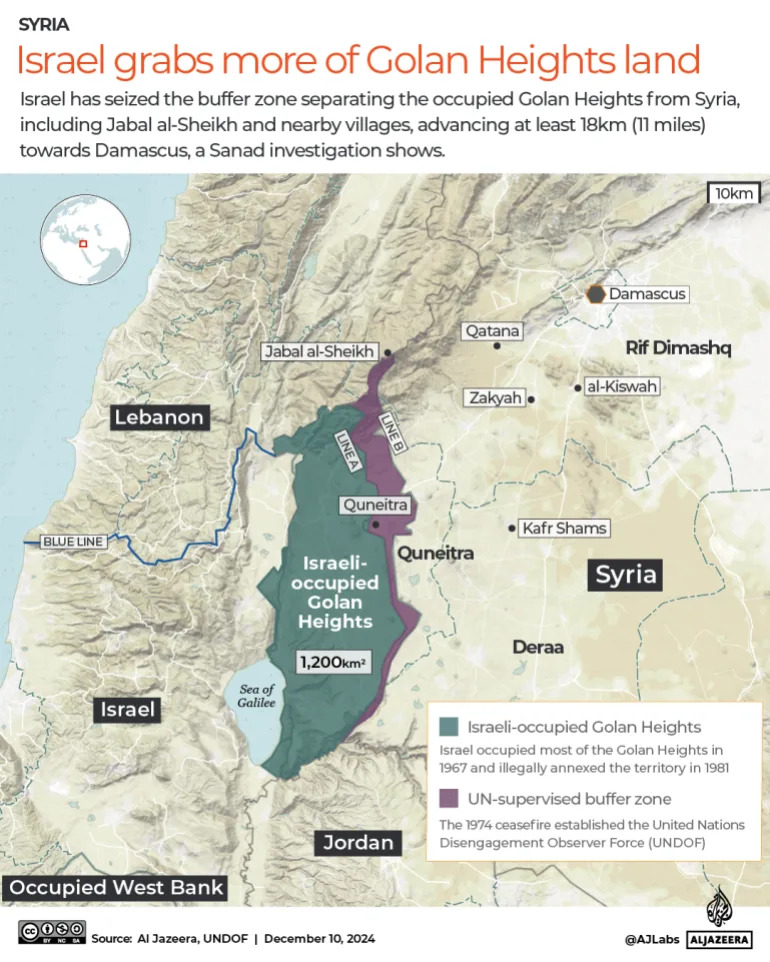
(Al Jazeera)
Mamoun Abu Amer described four linked dimensions of the strategy — security, political, ideological and psychological — and said holding adjacent territory gives Israel leverage in regional bargaining while reassuring a domestic public shaken by the October 7 attacks.
Experts counter that the approach is unsustainable. Drawing on the 2000 withdrawal from southern Lebanon, analysts warn that maintaining a 1,000 sq km footprint requires heavy logistical support — supply routes, fortifications, engineering, medical evacuation and continuous patrols — and risks stretching Israel’s reserve forces and economy. As Jabareen put it, what is intended as a buffer risks creating "permanent friction with three hostile environments."
The report concludes by highlighting the role of the international community: analysts say muted responses and an absence of firm measures have enabled the expansion, and they warn that without stronger international pushback the situation is likely to persist.
Help us improve.